


Select NOAA-NWS Forecast Office Text Products
(Product availability varies with seasons, forecast office, and weather.)
Forecast Discussion for Dallas/Fort Worth, TX
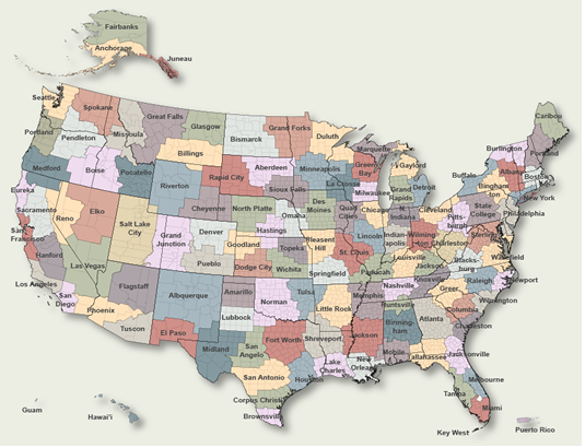
To Select Another NWS Office Click on Map or Choose from List
|
| Select Forecast Office: | Select Product: |
003 FXUS64 KFWD 221805 AFDFWD Area Forecast Discussion National Weather Service Fort Worth TX 105 PM CDT Wed Jul 22 2026 ...New SHORT TERM, LONG TERM, AVIATION... .KEY MESSAGES... - Dangerous heat will continue with widespread heat index values of 105 to 120 degrees expected this afternoon. - An Extreme Heat Warning and Heat Advisory remain in effect across North and Central Texas and will likely continue to be extended through the remainder of the week. && .SHORT TERM... (This afternoon through Thursday) Issued at 100 PM CDT Wed Jul 22 2026 A strong upper level ridge combined with high humidity will continue to bring dangerous heat to the region. Temperatures have already climbed into the mid to upper 90s as of midday, with heat index values already between 105-110 degrees for many locations. Actual temperatures will peak between 100-105 degrees this afternoon, with dew points only mixing out into the upper 60s to mid 70s for most of the forecast area. This will result in peak index values between 105 and 120 degrees, making for rather dangerous conditions. An Extreme Heat Warning and Heat Advisory remain in effect through this evening, and the Extreme Heat Warning was expanded to include Fannin, Delta, and Lamar counties. It will be best to limit time spent outdoors this afternoon. A weak cold front will slide into the region from the northeast through the afternoon, but will unfortunately offer little to no relief from the heat today. Despite strong subsidence beneath the upper ridge, there remains a low (10-20% chance) for isolated showers or storms to develop late this afternoon through early evening as the front moves through the region. However, most locations will remain rain-free. East to northeast winds are expected to prevail behind the front through Thursday. This subtle shift will be enough to turn the intense heat down just a tad, with much of the area actually remaining below 100 degrees Thursday afternoon. While the front will bring a brief period of drier air to the region tonight into Thursday morning, moisture ahead of TS Bertha in the Gulf will advect inland throughout the day, resulting in high humidity and peak heat index values between 100-109 degrees. As a result, a Heat Advisory remains in effect for most of the area through Thursday evening. && .LONG TERM... (Thursday night through next Tuesday) Issued at 100 PM CDT Wed Jul 22 2026 Hot conditions are expected to persist through early next week. Following a brief reprieve from the intense heat we`re currently experiencing, the upper level ridge will strengthen a bit over the weekend, resulting in the return of widespread triple digit temperatures. A shortwave or two may round the upper ridge into the region over the weekend but will be rather inconsequential outside of perhaps a slight increase in cloud cover. Heat headlines will likely be needed over the weekend and perhaps into next week for portions of the area (primarily North Texas) as heat index values will continue to climb above 105 degrees on a daily basis. There is no strong signal for rain chances through the end of the month, so the doldrums of summer appear to be upon us as we close out the month of July. && .AVIATION... (18Z TAFS) Issued at 100 PM CDT Wed Jul 22 2026 VFR conditions will prevail through the period. North/northeast winds will become more east/northeast as a weak front moves through the region this afternoon and evening and will remain generally out of the east through the end of the period. Wind speeds will mostly be between 5 to 10 knots but will see a brief increase to 10 to 12 knots between 21-01Z. There is a very low potential for isolated showers or storms to develop late this afternoon through early evening. The potential is too low to include any mention in the TAFs at this time, but we will monitor trends over the next several hours. && .SPOTTER INFORMATION STATEMENT... Spotter activation is not expected at this time. && .PRELIMINARY POINT TEMPS/POPS... Dallas-Ft. Worth 81 100 81 101 / 0 0 0 0 Waco 80 98 80 97 / 10 0 0 0 Paris 74 94 75 95 / 0 0 0 0 Denton 78 99 78 101 / 0 0 0 0 McKinney 77 97 77 99 / 0 0 0 0 Dallas 80 100 80 101 / 0 0 0 0 Terrell 77 97 77 98 / 0 0 0 0 Corsicana 78 98 79 98 / 10 0 0 0 Temple 80 99 79 97 / 10 0 0 0 Mineral Wells 77 100 76 101 / 10 0 0 0 && .FWD WATCHES/WARNINGS/ADVISORIES... Extreme Heat Warning until 8 PM CDT this evening for TXZ091>095- 100>107-115>123-130>135-143>148-157>162-174-175. Heat Advisory from 8 PM this evening to 8 PM CDT Thursday for TXZ100>105-115>123-130>135-143>148-157>162-174-175. Heat Advisory until 8 PM CDT Thursday for TXZ129-141-142-156. && $$ SHORT TERM...Barnes LONG TERM....Barnes AVIATION...Barnes |
Previous Forecast Discussions may be found at
NWS Dallas/Fort Worth, TX (FWD) Office Forecast Discussions.
(Click 'Previous Version' there to view past versions successively.
Some may differ only in time posted.)
Products Courtesy of NOAA-NWS
NWS Information Parsing Script by Ken True at Saratoga Weather - WFO and Products Scripts by SE Lincoln Weather.
Mapping by Curly at Michiana Weather and by Tom at My Mishawaka Weather.